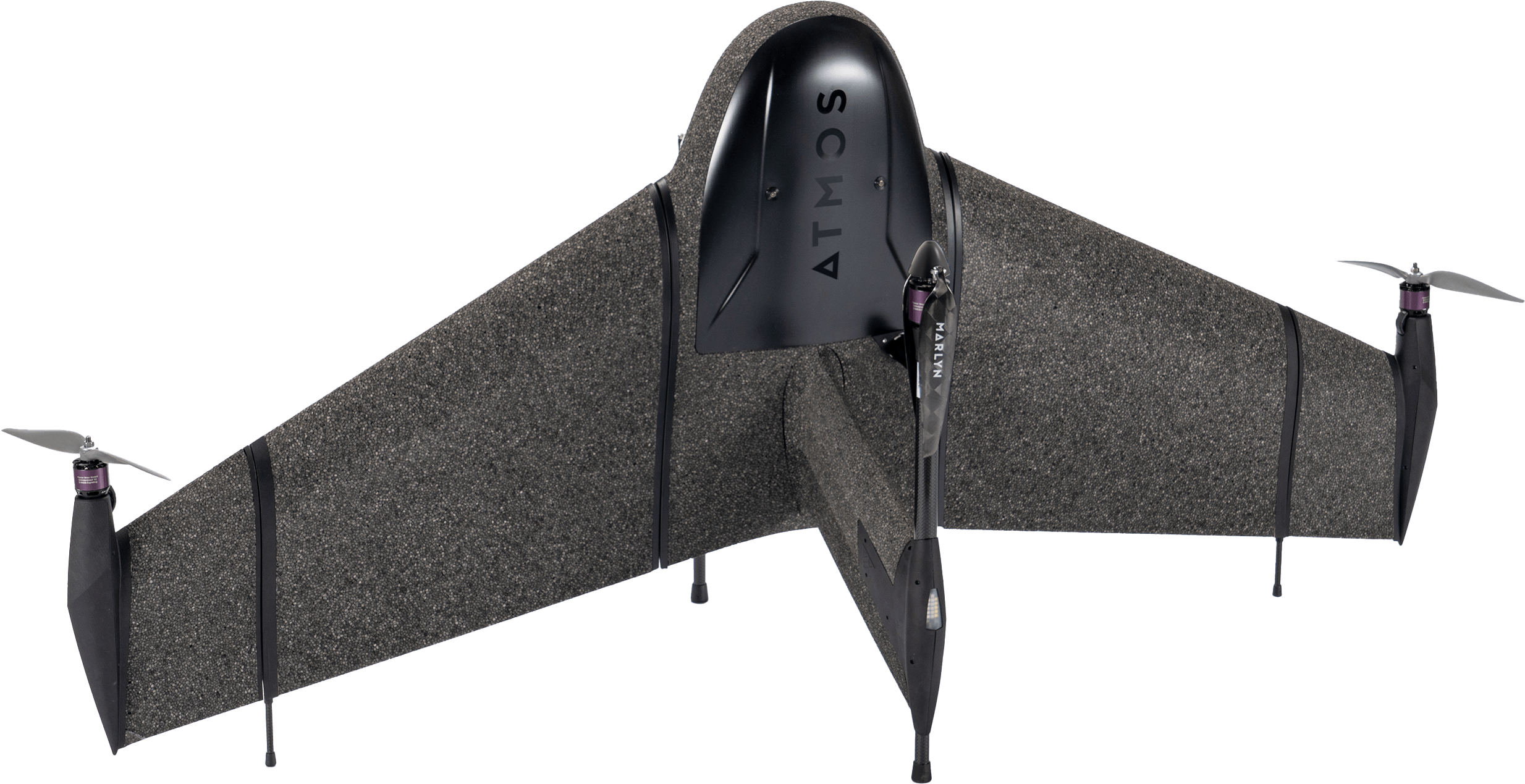
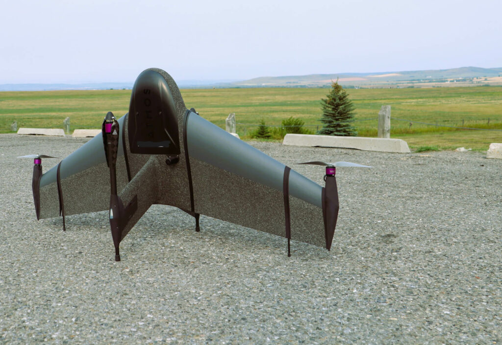
Marlyn Cobalt is a PPK-enabled hybrid — VTOL (Vertical Take-Off and Landing) fixed-wing drone designed for absolute accuracy and speed.
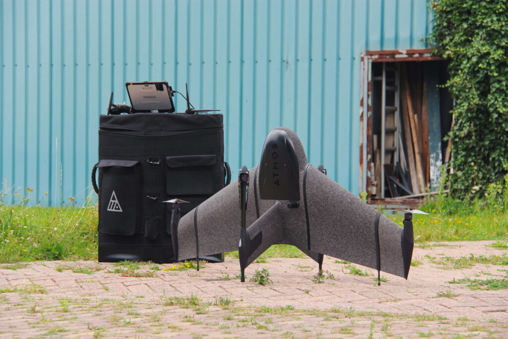
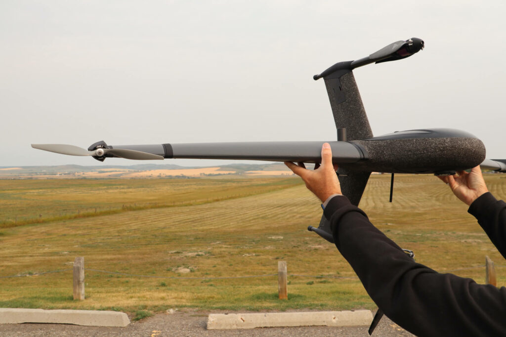
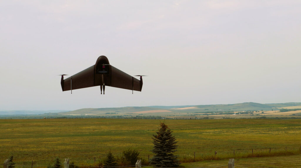
Rugged, flexible, and recyclable, the Marlyn Cobalt three-part EPP foam body has been engineered to operate in the most challenging conditions with increased surveying speed, accuracy, and control. With a cruise speed of 65 km/h and a flight time of up to 50 minutes, the wingtip-mounted propellers and large tail-fin give Marlyn Cobalt stability in survey/airplane mode while constantly correcting altitude to get the sharpest aerial images in the toughest of winds.
Advanced Software
Navigator and Geotagger comprise the professional software package included with the Marlyn Cobalt, enabling you to complete surveys with ease all while being supported by the best software available in the business.
Modular System for In-Field Swaps
Be ready for anything — need an accurate DSM followed up by a multispectral survey? Marlyn Cobalt’s compatibility with multiple cameras (Sony A6100, Sony A7RIV, MicaSense multispectral cameras) and quick-swap system mean you’re ready to fly again in just a minute.
Marlyn Cobalt
Advanced Software
Navigator and Geotagger comprise the professional software package included with the Marlyn Cobalt, enabling you to complete surveys with ease all while being supported by the best software available in the business.
Modular System for In-Field Swaps
Be ready for anything — need an accurate DSM followed up by a multispectral survey? Marlyn Cobalt’s compatibility with multiple cameras (Sony A6100, Sony A7RIV, MicaSense multispectral cameras) and quick-swap system mean you’re ready to fly again in just a minute.
Absolute Accuracy
Accuracy within 1 cm using Sony’s 42MP, full-frame A6100 integrated with a high-end GNSS receiver for PPK for professional aerial surveying.
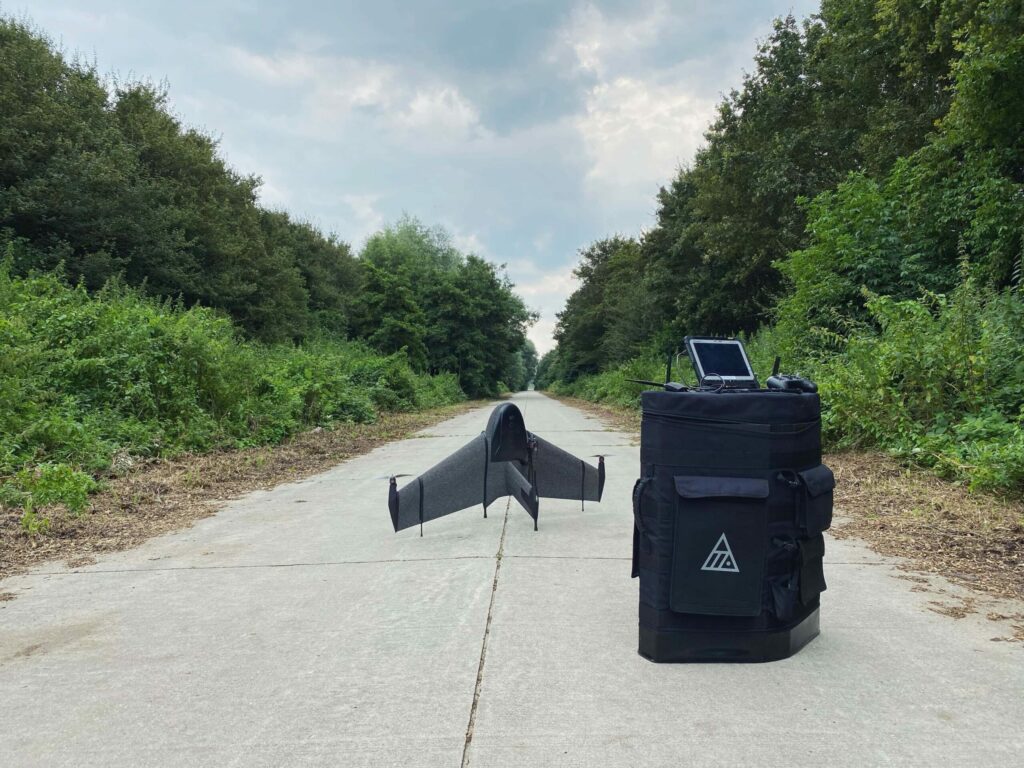
Quick & Easy Assembly
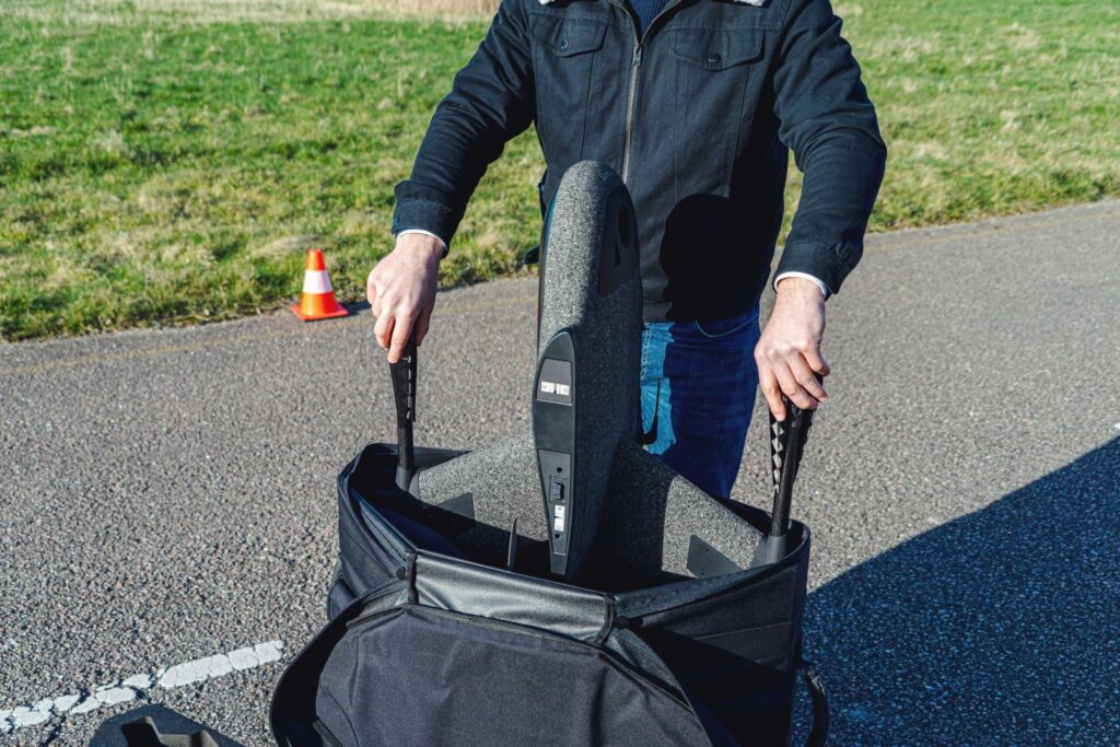
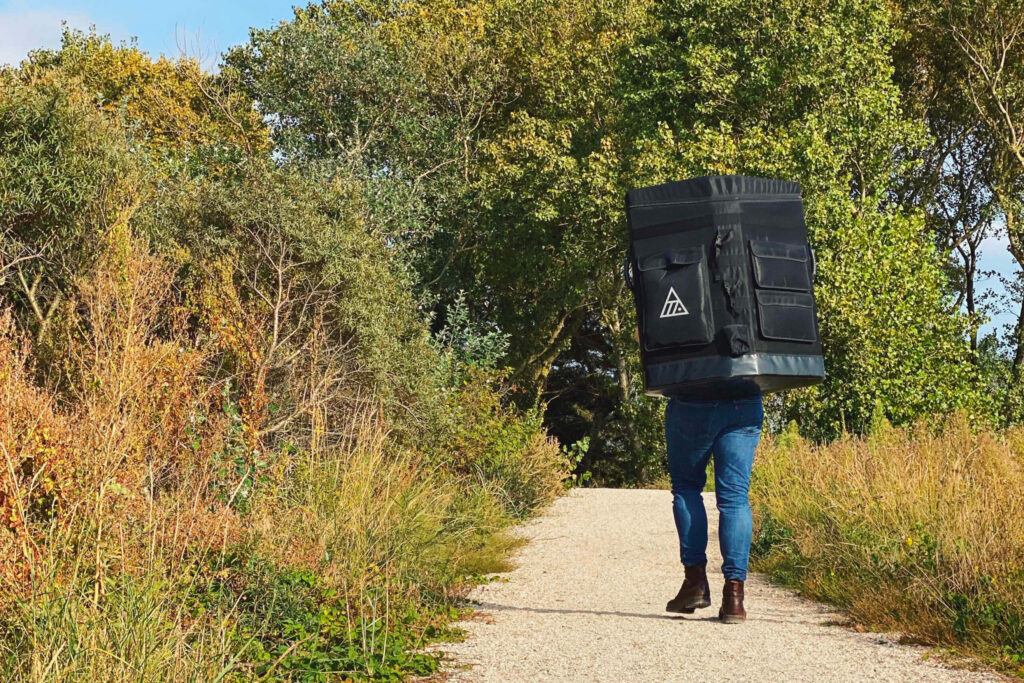
The Marlyn Cobalt three-part EPP foam body can be assembled by one person in less than a minute. Easy backpack transport is also perfect for those heading off the beaten track.
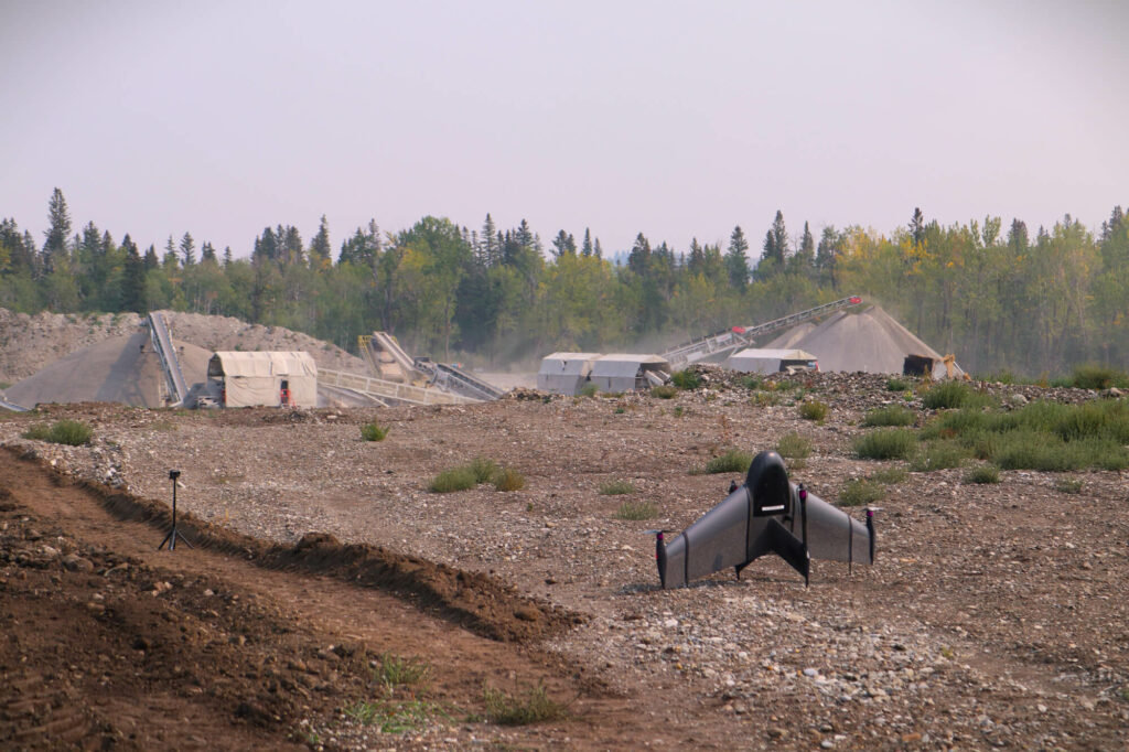
A UAV DESIGNED TO FLY WHEN AND WHERE OTHERS CANNOT
Wind conditions of up to 28mph (45km/h) at ground level and 34mph (55km/h) at cruise altitude, resulting in more days spent flying and fewer days stuck on the ground due to changing weather patterns.
Survey Anywhere
Needing only a 6.5x6.5ft (2x2m) flat area to take off and land, Marlyn Cobalt allows for greater flexibility in a wide range of terrains and surveying situations.
Increased Efficiency
Speed up your data capture by surveying large areas up to 30x faster than traditional land surveying methods, and up to 10x faster than Multicopter drones.